The purpose of AUDITOR to develop:
AUDITOR will enable cost-effective precision agriculture services to farmers, especially those with small and small-sized businesses in areas of Europe where EGNOS availability may be poor under certain conditions.
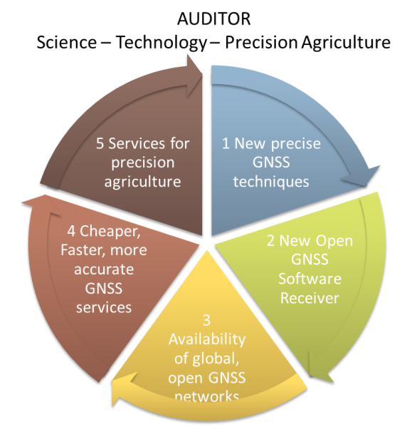
GNSS network software that enables enhanced features, including advanced precise positioning with high accuracy and fast fix mainly based on Wide Area Real Time Kinematic, (WARTK).

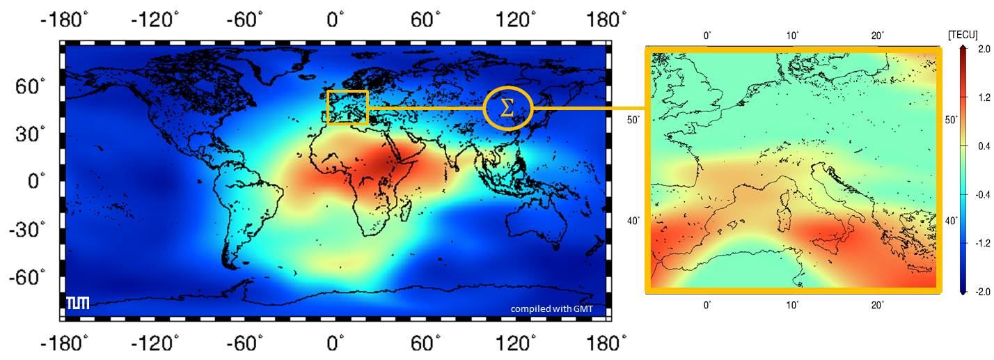
Global (low resolution, left image) and regional (high resolution, right image) ionosphere products for the calculation of real-time corrections. These enable a precise navigation with a shorter cold start time. Sudden enhancements of ionospheric conditions are handled with an autonomously down weighting of highly disturbed satellite signals.
Flexible dual-frequency GNSS receiver platform, hardware/software hybrid, with SDR-based low-power embedded receiver, fully reconfigurable, which will serve as a test-bed for advanced signal processing algorithms, and with low-level access to data in order to enable new functionalities. It will be Galileo/EGNOS enabled, with reconfigurable front-ends for alternative double band operation (L1/E1 and selectable L2 or E5), and a commercial off-the-shelf (COTS) approach for hardware components enabling short time-to-market through a faster implementation process
Implementation of GNSS augmentation methods based on open software, including observable generation base on GNSS-SDR and data exchange within the user receiver based on RTKlib
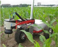
Web-based platform to collect, store and process geo-referenced data for precision agriculture and mobile applications. Services will be provided through an intuitive mobile and web interface, adapted to the needs of farmers. The platform will be highly automated, and simple to implement in different landscapes/agricultural.
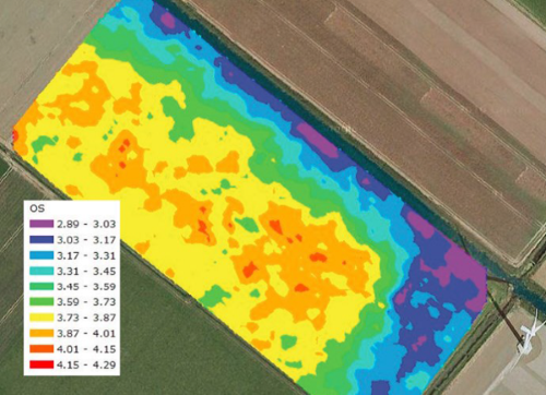
Services in precision agriculture based on the above, including data collection and recommendations to farmers regarding site-specific application of water, fertilizer and pesticides.

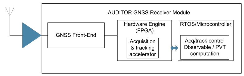
AUDITOR architecture is based on a GNSS front-end and an embedded digital processing platform that implements a custom GNSS SDR receiver that also provides integration with cloud services.
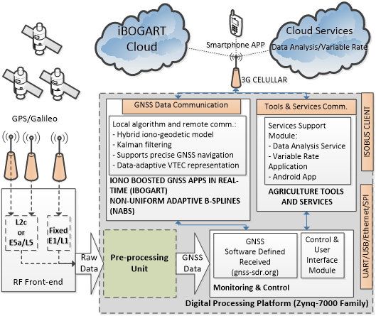 Key technical elements
Dual-band RF GNSS front-end: configurable RF dual-band multi-constellation receiver which acquires the GNSS signals. The FE embeds all analogue and digital hardware required to convert the RF signal to digital samples. It provides a data output interface with I/Q samples, clock and a management interface (UART/SPI) to configure its main parameters.
Pre-processing unit: high performance real-time processes that perform the signalacquisition and conversion of the GNSS signals. These cores are customized for theAUDITOR systems using Zynq tools in VHDL language. The main features of the IP cores that will be integrated in this module are: